Stereographic
Advertisement
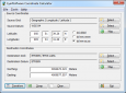
Eye4Software Coordinate Calculator v.3.2.12.208
Eye4Software Coordinate Calculator is a very easy to use tool to perform gps coordinate conversions. Supported projections: Transverse Mercator, Lambert Conformal Conic, UTM, Gauss Kruger, Stereographic, Albers Equal Area, Oblique Mercator and more.
Advertisement
SingleCrystal v.2.1.3.300
SingleCrystal is an elegant program designed to make the world of diffraction, reciprocal lattices and stereographic projections intuitive, interactive and fun!
WinWulff v.1.2.0.1
WinWulff is a program for plotting stereographic projections of (hkl) and [uvw] vectors onto a Wulff-net. It is the successor to JWulff and the JWulff module in JCrystal.
Panoweaver Professional Edition v.7.0.0.1
Panoweaver is an image stitching tool, merging different pictures into a high quality, 360 degree panoramic view or into different partial panoramic view types. The application imports JPG, TIFF, BMP, PNG and various RAW format images.
SHPTRANS v.1. 1. 2004
SHPTRANS is a fast, high-precision NTv2 datum transformation and projection utility which reads and writes shapefiles. SHPTRANS is intended to complement, not replace, existing projection tools such as those within ArcView GIS 3.x and ArcGIS 8.x.
Wolfpack v.7.1.3
WolfPack software is for educational use. It includes: -Wolfpack.exe: The executable program. -Wolfpack.
PHOTOMOD GeoCalculator v.4.4.682
PHOTOMOD GeoCalculator is the software for points coordinates transformation, included in the PHOTOMOD system, as well as a stand-alone free application.
Dips v.5.108
Dips is designed for the interactive analysis of orientation based geological data.

Eye4Software GPS Toolkit for Java v.4.0
Java toolkit to add coordinate conversion functionality to software (GPS API). Support for datum conversions and coordinate conversion using different map projections.
Hydromagic v.4.1.12.315
Eye4Software Hydromagic is a hydrographic survey program tool, which can be used to map areas using a GPS and echosounder. Use the program to import, view and edit your maps, display your position and to record depths.